


Exploring the Ruins of Butler Wash

We drove from the Page AZ and Lake Powell area towards the southern tip of Cedar Mesa on Thursday, expecting to find a spot and camp in the Valley of the Gods. I was expecting the valley to be even more crowded than usual as Monument Valley continues to be closed to tourists because of the pandemic.
There was traffic but not more than we saw two years ago. We made the long 30 minute drive (covering only about 10 miles) to the apex of the road (near Road Canyon and Fish Canyon exits from Cedar Mesa) where we had camped before. After discussing our plans for the next few days, and remembering that our vehicle is our campsite, we deciding that camping the valley was the wrong choice. If we are going to spend the next 1-2 days exploring Butler Wash, why not just camp in Butler Wash? So we backtracked and made our way to the relatively decent Butler Wash Road that parallels Comb Ridge on the east side.
But… not before we took a selfie at our old spot.
Comb Ridge is a jagged reef (monocline) that runs from just south of Blanding, UT all the way down to Kayenta, AZ; about 80 miles long. It isn’t terribly high – the “teeth” of the comb (I like to think of them as shark fins) reaching to a peak of around 5400 ft, about 800 feet above the washes on either side. Comb Wash lies to the west of the ridge, and Butler Wash to the east. The west side of Comb Ridge is mostly sheer cliffs facing Cedar Mesa (and further south, overlooking Valley of the Gods). It is on the sloping east side that there are a series of canyons running perpendicular to the ridge that you will find the remnants of the ancient settlers that inhabited them.
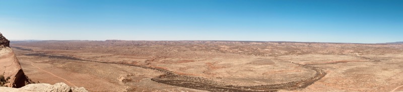
The image above is a pano I took when we climbed to the top of the ridge mid-day on Friday. You can see the dense foliage and cottonwood trees along Comb Wash, the red stripe to the left is Comb Wash Rd. Cedar Mesa is the plateau in the distance. We were traveling on the other side of the ridge along Butler Wash Rd.
We worked our way south to north along the most interesting part of Comb Ridge, the area between highways 163 and 95. We ended our Thursday moving day with a visit to two different sites near the famous Wolfman panel. Note that we skipped the Sand Island ruins south of US 163 as we had visited them before.
A brief note about visiting these ruins: I’m not going to give detailed descriptions on how to find each of them. There are plenty of guides out there (and even books?) and, interestingly enough, many of them are marked on old USGS topographical maps. I like using the amazing CalTopo app and website to search for map sets that contain place markers. When driving up Butler Wash Road you’ll do fine by just looking for trailheads marked by the (very well maintained) portapotties.
Enhanced:
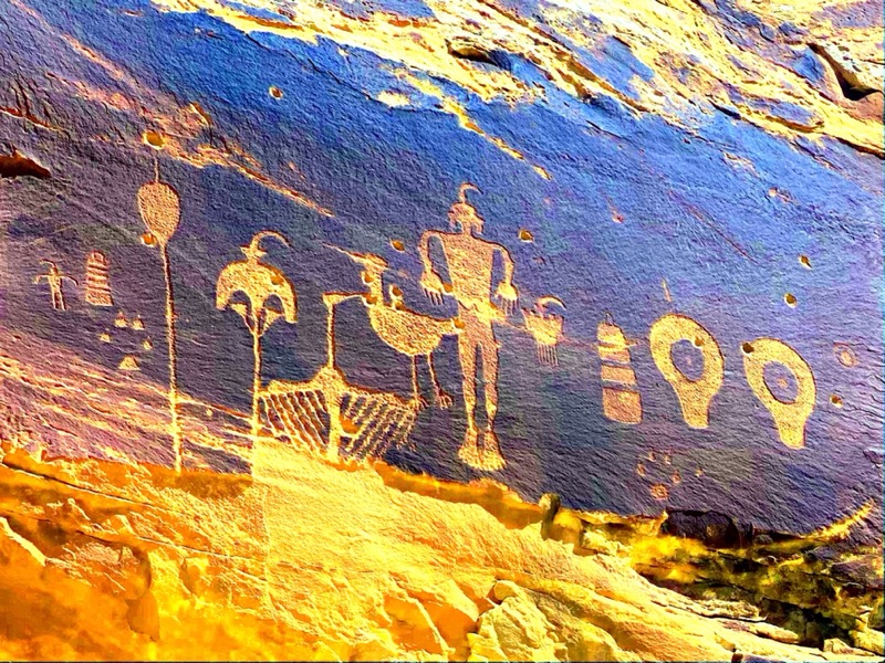
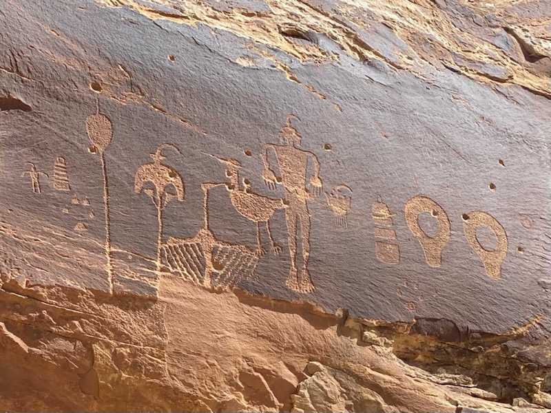
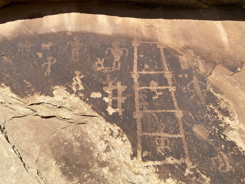
The Wolfman Panel is a large set of varnish etchings. We typically see three types of art: pictographs (painting on rocks of various colors), petroglyphs (carvings into rock), and these etchings. I’m not sure if the etchings are considered pictographs or petroglyphs, but I think they are more recent like the pictographs. My understanding is that many of the petroglyphs are more ancient, and often more abstract. In the images above I’m showing the original photo I took of the Wolfman panel, along with a filtered view using the iDStretch app which was designed deliberately for looking at pictographs in different color spectrums by using different color filters. The app doesn’t do much more for petroglyphs than a good contrast filter built into your camera app, but for paintings it can bring out “hidden” colors that are hard for the naked eye to see. We learned about this app from an interpretive ranger at Hueco Tanks near El Paso.
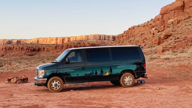
This is all BLM land with allowable dispersed camping, so we found a nice spot overlooking the wash and facing Comb Ridge and camped out in our van on Thursday night. That is Tank Mesa you see behind the van, which is east of Comb Ridge.
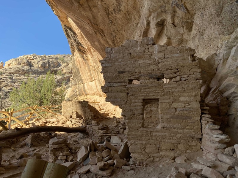
Friday morning we packed up and drove north a mile or two for our first canyon exploration of the day. This was for a (as far as we know) nameless ruin that we are calling Mr. Bill Ruin. If you get the name, you are probably at least 50 years old.
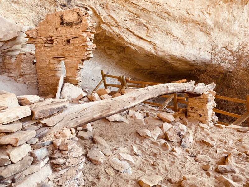
Here we saw something unusual to us: the incorporation of a long log beam into the structure. Was this for sitting on? Was it part of a wall that has since decayed between the two end posts? Building your own narrative of how and why is a big part of the attraction of these visits.
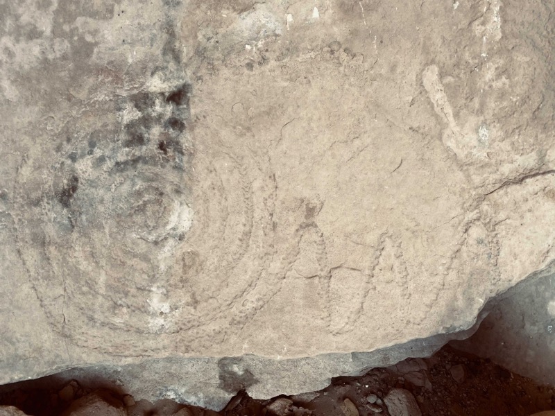
There were also several interesting petroglyphs here. Note the common spiral theme, but with an interesting trailing zig-zag.
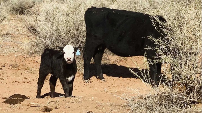
The Butler Wash is a free range cattle area, and a small herd was all the way up in the canyon when we arrived. They decided to join us as we left the canyon. One got separated behind us and became a bit stressed. We stepped off the path and allowed it to race past us to rejoin its family.
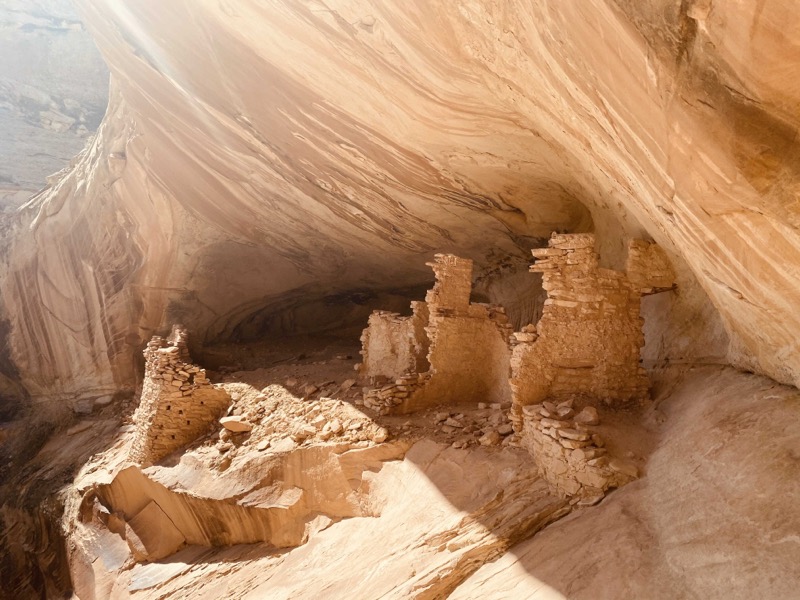
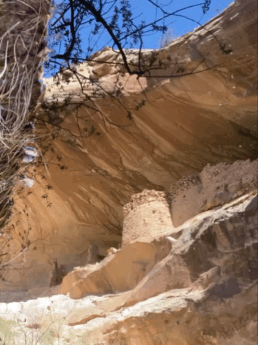
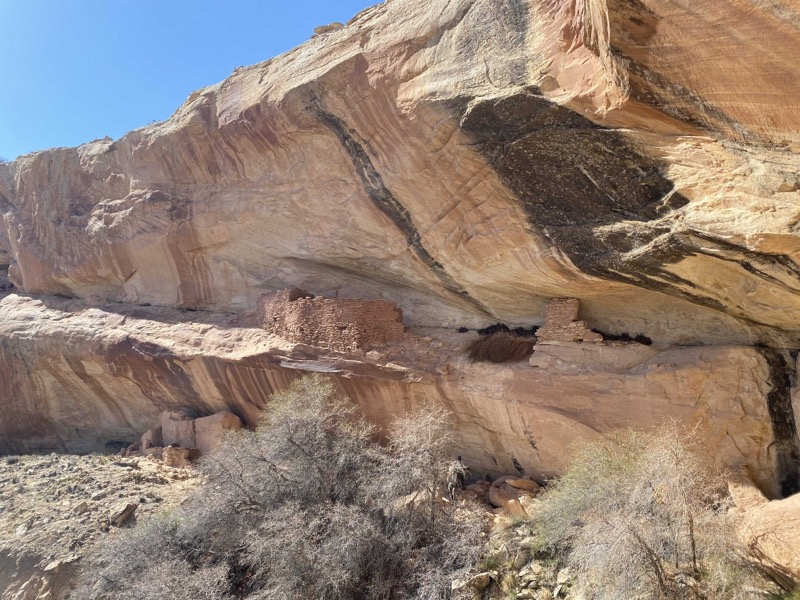
Next we moved on to the impressive Monarch Cave Ruins, which have a notable deep recess cave behind them. This was true of a few ruins we found along the ridge, and we wonder if they used the caves for additional dwelling space or storage.
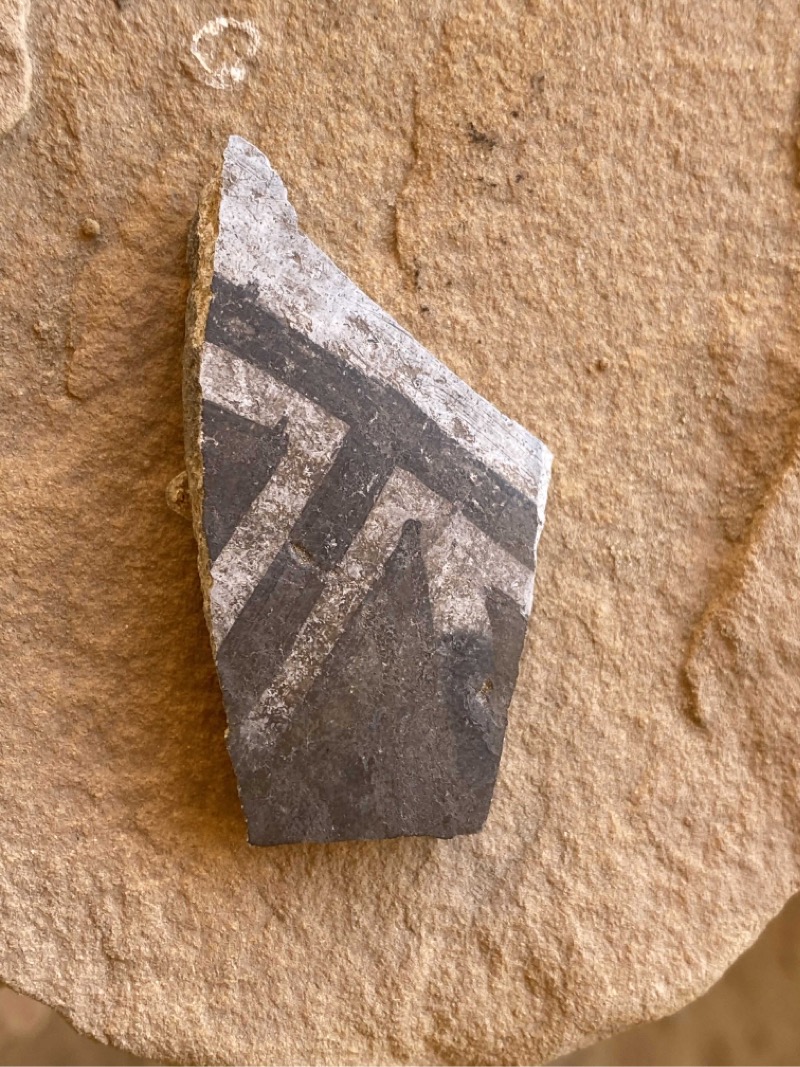
Here we found one of the more impressive pottery sherds we’d find all day, this one with high contrast black painting.
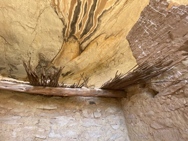
One of the structures still had partially intact roof thatching. You can see above the thatching the beautiful varnish formed by the constant water seepage in these caves. It is all too easy to discount the natural beauty in these canyons when you get so focused on the ancient dwelling ruins.
There is a fractured metate, a worn-down grinding stone ostensibly for grinding corn into meal. I think there’s evidence of the damage this process did to the teeth of the ancients, resulting from the high concentration of rock and sand that remained in their cornmeal from this grinding process.
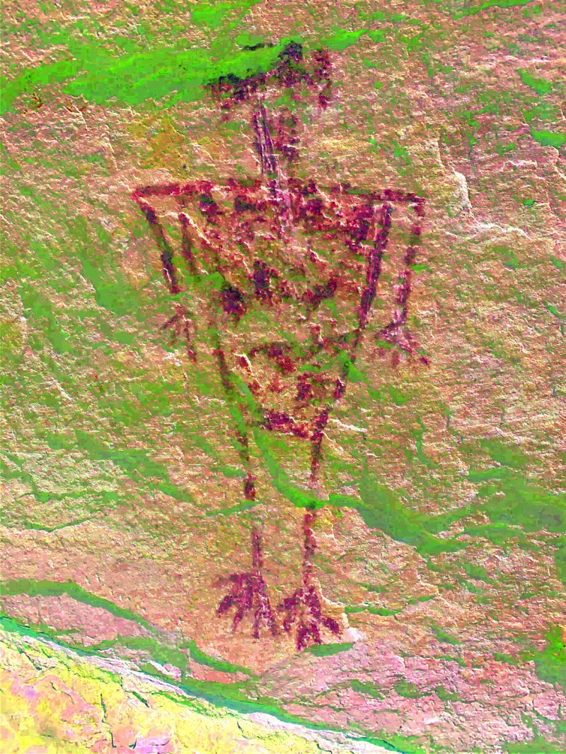
And of course there were pictographs here, this one an archetypical trapezoid man with some form of head dress.
At the bottom of the canyon (and the end of this box canyon), there is a permanent seepage pool that was perfectly flat and full. I landed on it at a perfect time to get a beautiful shot of the ruins through the water.
Rather than return to the van, we decided to canyon hop and and work our way north to more ruins. We were able to do this without exiting the canyon and returning to the wash. There are social trails and just good old slick-rock to traverse between the canyons. My map indicated more ruins three canyons up, so we headed there and climbed in.
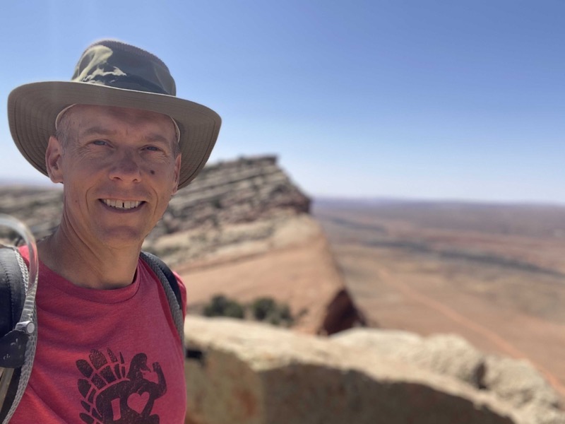
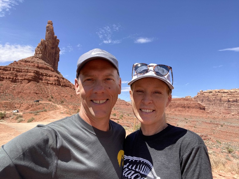
We didn’t see any ruins here on the way up, and wonder if this was the “eagle’s nest” ruins we had heard of that are high up on only reachable by repelling down from the top of the canyon. I checked the topo map and realized we were only about 200 feet in elevation below the top of the ridge, so we decided to climb out and see if we could make it to the top and get a view out the west side. Julie had to do a work phone call or two (we had good phone service but terrible internet service) so I climbed out further onto one of the teeth of the ridge and took this selfie along with the pano you see at the top of the post.
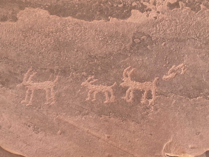
On the way back down the canyon we did find something: an amazing etching panel, and some deer petroglyphs. Whenever we find something like this on a second pass I can’t help but wonder how much we miss each time we wander through an area. It pays to slow down and just scan.
Julie remembered that one canyon over back to the south she had noticed a well-traveled trail into the canyon and suggested we explore that one. I wasn’t thrilled about the idea; we had already covered about 6 miles on this journey and I was ready for lunch and a nap. Still, I relented and am so glad I did.
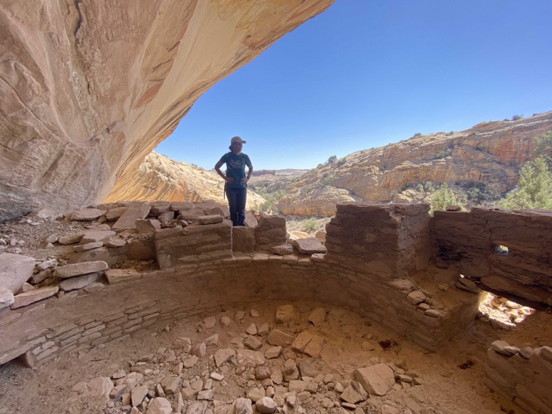
We were rewarded with our first kiva find of the day. While not fully intact, it had the submerged base and mostly present circular foundation.
Most impressive was the combination metates and petroglyph.
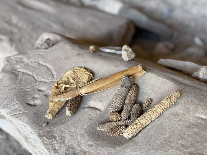
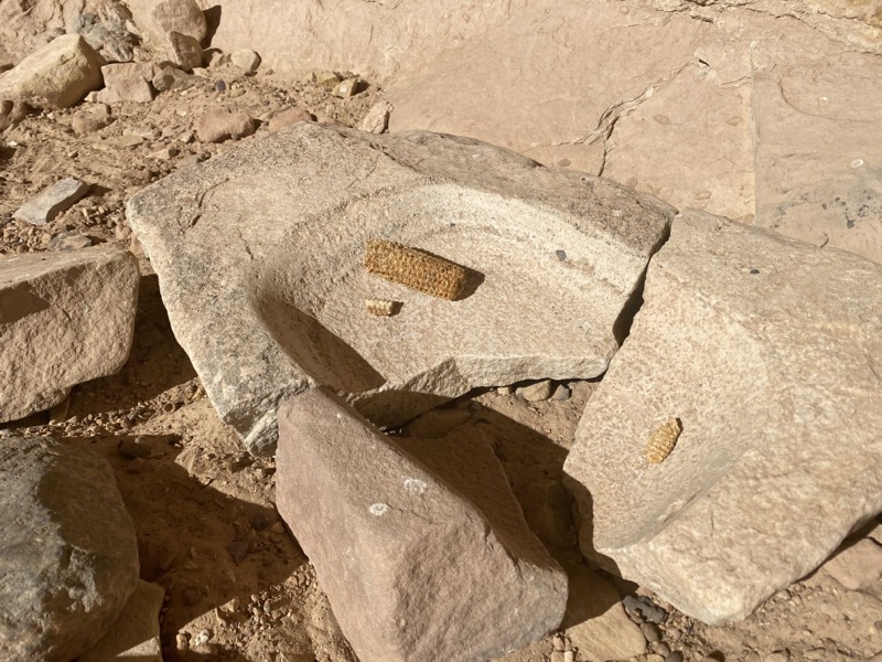
In another set of metates someone had gathered some corn cobs and, new to us, some husks. Note: archaeologists today do not approve of this sort of gathering (be it cobs, arrowheads, sherds, whatever). Keep these artifacts in situ where they lie.
Our next canyon to explore on this full day (over 13 miles of hiking) was split-level canyon. You can see the two levels in the photo above. I can’t say enough how much I want to find a way to visit these upper levels, but usually cannot. It wasn’t for lack of trying on my part. I ventured up canyon and tried to scoot my way along a sloping narrow ridge to find a way to reach the upper level. Usually when my heart starts racing and I worry about getting my way back down (up is always easier than down) and turn back.
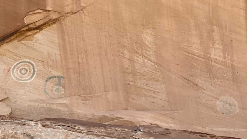
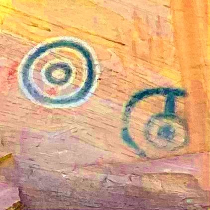
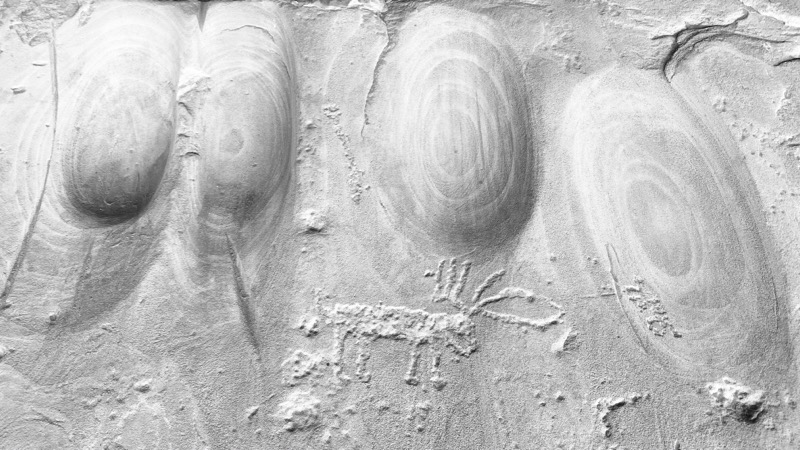
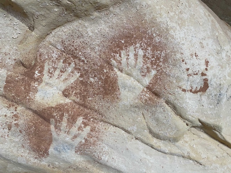
Why did I want to find my way to the top? Not for the structures, but to get closeup photos of three different colored pictograph circles. Above you see the original photo of the three, and zoomed-in filtered version of the two prominent drawings on the left. I guess I still got decent photos.
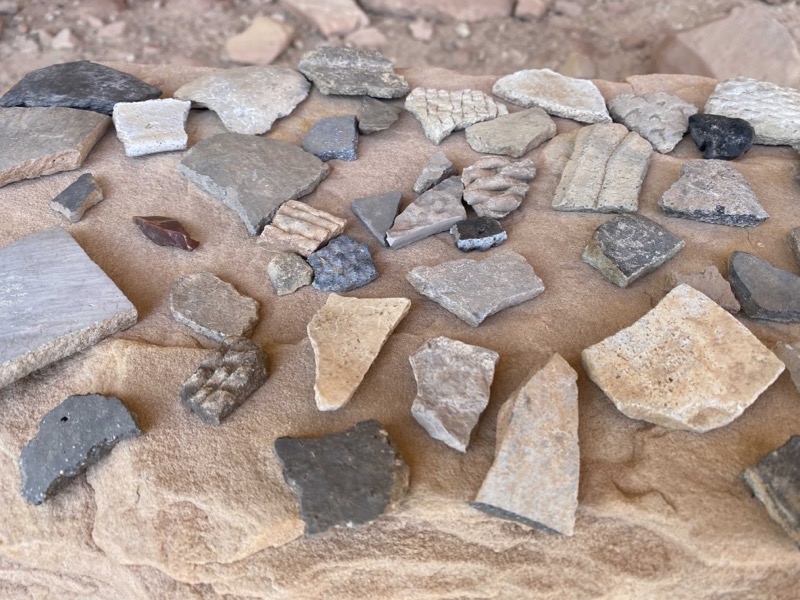
There was also an impressive, if unauthorized, collection of pottery sherds and sharpened rocks. Note the beautiful scalloped layers in this set.
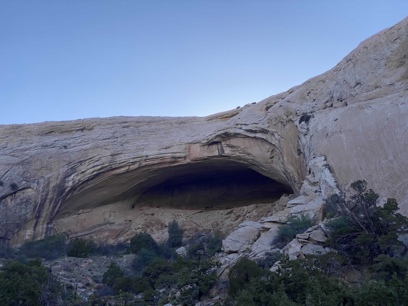
Our final canyon of the day would be what we learned was named Fish Mouth. We were worn out and this might have been a canyon too far for us, but we managed. Also had a chance to talk to a very nice retired couple from NJ who spend their winters now in Moab.
There were some decent pictographs and ruins on the way up to the top of the canyon at the fish mouth. We would learn that the best of the canyon was along the way, because the final cave at the top had long since been looted; probably back in the 19th century.
Still, the geology of this final cave was striking and we enjoyed just sitting in the cave and looking back out over the wash and Tank Mesa.
In all that was a day and a half of exploring Butler Wash. We covered a lot in the second day, and in hindsight maybe two full days would have been better. We are still here around Cedar Mesa and are picking up a few other spots we had missed on prior spots.