
Orienteering at Mt Tabor
I love maps and navigation and have enjoyed teaching orienteering to Boy Scouts in the past. A few summers ago I even took over an orienteering merit badge class being run by an older scout that hadn't even learned the basics. Despite my love for map & compass, backpacking, and navigation I never participated in the official sport of orienteering -- at least not until last weekend.
Last Saturday I joined the Columbia River Orienteering Club at Mt Tabor for a free beginner-oriented event. I spent some time reading up on the basics of the sport. Our own club has some great content: start with the beginners guide then check out the Orienteering: "O"-1-2-3 page. One surprise for me going in is that there is very little compass work involved in the beginner and intermediate levels. This sport is mostly about map reading, knowing where you are, and making good tactical choices about how to approach the different controls on a course.
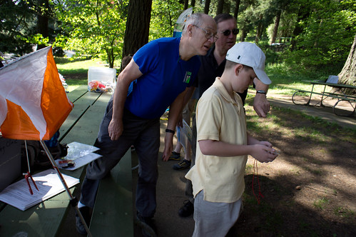
I showed up at Mt Tabor right when they opened up registration and waited briefly for the beginner class. The friendly volunteer handling registration talked me out of the beginner White course which is primarily intended for kids. I decided to do the Yellow (advanced beginner) course, about 2.4km long. I was wearing my Vibram Fivefingers KSO Trek and ready for some cross-country action. This course kept me mostly on the roads and trails around Mt Tabor, but there was plenty of climbing involved. There are enough cross-paths and man-made structures around Mt Tabor that I never had problems finding good attack points to find the controls. I finished in just under 30 minutes.
What are you actually doing on the course? Following the map, looking for the next numbered control (and orange and white flag on a pole or hanging from a tree -- you can see an example in the above photo), verifying that the control number matches the one on your card, then finally punching your control card with a special punch that will allow the scorekeeper to verify that you went to the proper control. Repeat for each control.
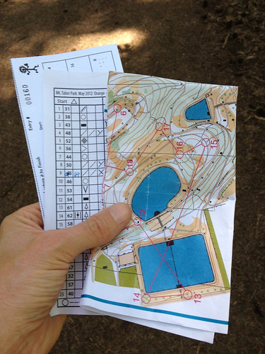
Feeling ready for more I grabbed another map and control card to attempt the Orange (intermediate) course, which was 4.6km. This distance was a bit misleading given the location and weather. Surprisingly for Portland it was sunny and hot, and this course took me all around Mt Tabor (up and down). Now is a good time to mention that I generally ran from control to control -- I love trail running and am partly interested in this sport as a way to have fun while training. I was exhausted after completing this course in just over 57 minutes. I felt that I was moving along pretty well, mostly running but having to walk at times when climbing 400-500 feet. You can see from the results that some of these folks really move fast through the course. One of the volunteers told me that 10 minutes per KM is a good time, add a bit if you have a lot of up-and-down or the terrain is rough.
Unfortunately there aren't any scheduled events I can make until the end of the summer, but Julie and I plan to return to Mt Tabor and do the Mazamas orienteering self guided training course before we head to Philmont in late July. This training course is geared towards learning back country navigation skills, not the sport of orienteering.